News:
Our research was featured in Jornal da USP
[publication]: Paper published in the Journal of South American Earth Sciences
[publication]: Paper published in GI_Forum
[publication]: Paper published in Remote Sensing
[publication]: Paper published in the 8th International Conference on Debris Flow Hazard Mitigation (DFHM8)
[publication]: Paper published in the International Journal of Remote Sensing
[publication]: Paper published in the Bulletin of Geodetic Sciences
[publication]: Paper published in Remote Sensing
[publication]: Paper published in the IEEE Journal of Selected Topics in Applied Earth Observations and Remote Sensing
[publication]: Paper published in Landslides
[publication]: Paper published in the Brazilian Journal of Geology
[publication]: Paper published in Geosciences
[publication]: Paper published in Natural Hazards
[publication]: Paper presented at the XIII International Symposium on Landslides
About:
Landslides are common geological phenomena in high-relief areas, occurring across a range of spatial and temporal scales, and are considered the main erosive process in the geomorphological evolution of such areas.
When occurring close to inhabited zones their destructive effects cannot be underestimated, as well as their capacity to modify the landscape and the huge amount of debris carried to streams and rivers, which may impact water distribution and the environment.
We have a continuous interest in landslides, with students working on their characterization from a morphological point of view with high-resolution DTMs, recognition and mapping with orbital mutispectral imagery, and evaluating the risk imposed by such events to urban settlements.

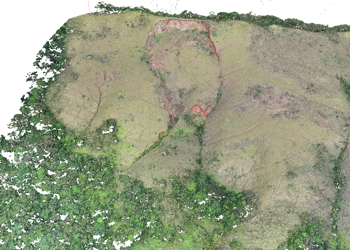
3D model of a landslide near the coastal region of São Paulo State

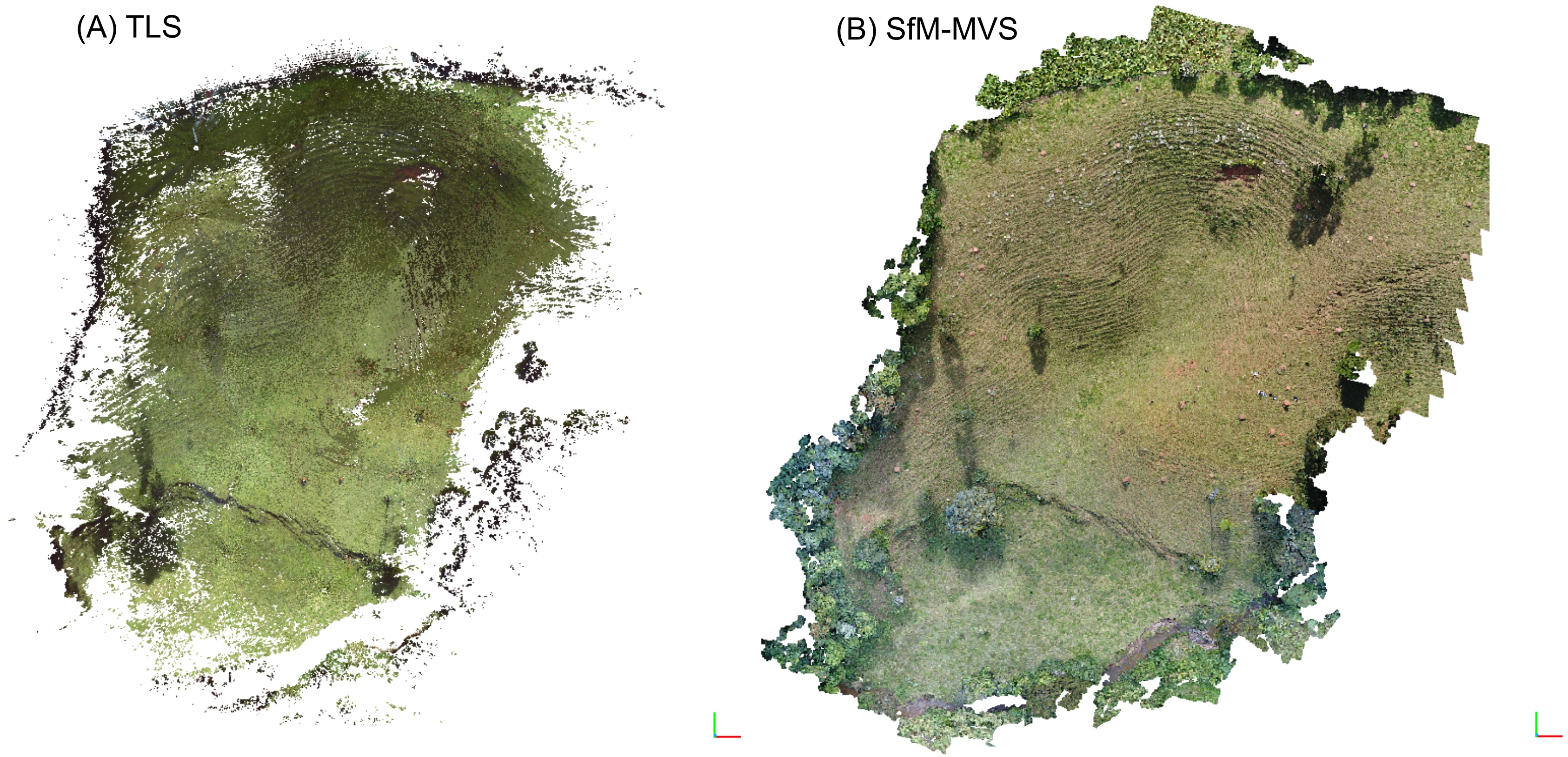
3D models of a small landslide - left: terrestrial LiDAR; right: UAV data
Spammers:
Amanda Mendes de Sousa (MSc 2019-2023) - Monitoring landslide susceptibility: using UAVs to generate 3D models for slope stability analysis in urban areas
Elton Barbosa Gomes (undergrad 2018) - Stability analysis of mass movement-prone areas based on High-resolution Digital Terrain Models
Guilherme Pereira Bento Garcia (PhD 2018-2023) - Detection and monitoring of landslides on natural slopes from integrated application of multispectral images and high-resolution elevation models
Francesco Barale (undergrad 2019) - Modelling of a small landslide with Terrstrial Laser Scanner.
Helen Cristina Dias (PhD 2019-2025) - Analysis of manual and semi-automatic shallow landslides inventories and its suitability in predictive models
Lucas Pedrosa Soares (MSc 2020-2022) - Automatic segmentation of landslide scars in remote sensing imagery with deep learning
Luiz Fernando dos Santos (MSc 2017-2020) - Application of High-resolution Digital Terrain Models in slope stability and mass movement analysis
Rebeca Durço Coelho (PhD 2021-2025) - Multi-Scale Geomorphometric Analysis of Mass Movements in São Sebastião (SP, Brazil)
Vitor Batista dos Santos (undergrad 2018) - Analysis and 3D modelling of landslides by terrestrial LiDAR and Structure-from-Motion
Grants:
FAPESP #2023/11197-1 - Multi-Scale Geomorphometric Analysis of Mass Movements in São Sebastião (SP, Brazil).
FAPESP #2019/26568-0 - High-Resolution Remote Sensing, Deep Learning and Geomorphometry in Analyses of Mass Movements and Geological Risk.
CNPq #423481/2018-5. - UAV-based high-resolution imaging in geological, geomorphological and environmental analysis.
FAPESP #2016/06628-0 - Application of high-resolution digital elevation models in geology and geomorphology.
Collabs:
IPT – Institute for Technological Research
Z_GIS - Centre of Competence for Geoinformatics (Un. Salzburg)