News:
[publication]: Paper published in Computers & Geosciences (also availabe as a preprint at arXiv)
[publication]: Extended abstract published in the proceeding of Geomorphometry2020
[video] - Short video of our field trip
[blog post]: Field trip to Garopaba
About:
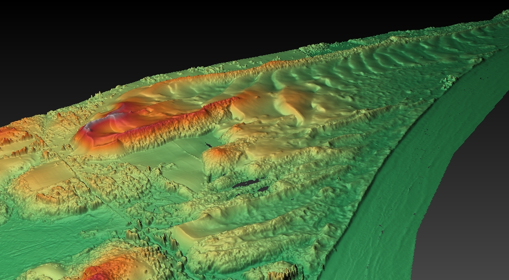
Back in 2010 we acquired an airborne LiDAR survey of the Garopaba Dune Field, located in southern Brazil about 45km south of Florianópolis (see it in Google Maps), as part of the research grant FAPESP #2009/17675-5. We created some nice DTMs and evaluated how the calculated volume of sand would change with different spatial resolutions of the DTM (Grohmann & Sawakuchi 2013).
In 2019 we went back to create a new DTM, this time using TLS and SfM-MVS. You can check the results in the paper published in Computers & Geosciences (also freely availabe as a preprint at arXiv)
Video - Garopaba fieldwork
Garopaba Dune Field (Dunas do Siriú) by SPAMLab on Sketchfab

DTM of the Garopaba Dune Field (image created with Planlauf Terrain)
Grants:
CNPq #423481/2018-5. - UAV-based high-resolution imaging in geological, geomorphological and environmental analysis.
FAPESP #2016/06628-0 - Application of high-resolution digital elevation models in geology and geomorphology.
FAPESP #2009/17675-5 - Digital terrain analysis and remote sensing applied to geomorphometric characterization of landforms.